Precision Farming for the cereal harvest – harvesting via satellite images
Precision Farming uses sensors and satellites to manage specific field areas. Such issues as soil irregularities or differences in the productivity of a field are taken into consideration and can be managed using digital field mapping. This enables targeted sowing, fertilisation, plant protection treatment as well as harvesting and can reduce the use of resources. Overall, Precision Farming can be used in almost all operating areas:
- Farm management (farm management and quality management)
- Stock management (sowing, fertilisation, plant protection, harvest)
- Machinery management (site monitoring, machine monitoring and control, route planning)
- Work management (automatic steering, manned and unmanned guidance and satellite vehicles)
When it comes to the cereal harvest, Precision Farming can facilitate quality differentiation on the field itself. This reduces the need for more difficult separation processes using post-harvest technology. For example, a partial area can be differentiated by moisture content using test drives or yield maps from past years. Another option is differentiation based on the constituents of the crops in different areas. This can be done by separating the collecting tanks or leaving lower-quality areas of the crop.
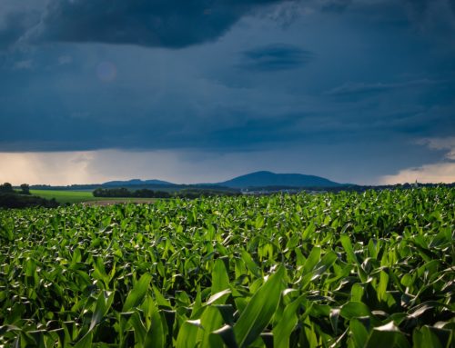
Satellite images as the basis for harvesting decisions
Quality differentiation on the field can be checked by reviewing the vegetation by means of satellites. The European Copernicus programme includes various measuring stations (on the ground, in the water and in the air) and satellites. These continuously record data on the state of the Earth, which are processed for climate studies, weather forecasts, wind energy maps and harvest statistics. The satellites and instruments were developed by the European Space Agency, ESA. The first satellite, Sentinel-1A was launched in 2014. Currently, the Sentinel satellite family consists of six different missions: Sentinel 1, 2, 3, 5P and 6, plus Sentinel 4 and 5, which operated as measuring instruments on meteorological satellites.
Sentinel 2 satellites are optical satellites that were launched in 2015 (Sentinel-2A) and 2017 (Sentinel-2B). All of the 13 channels are optimised for the observation of land surfaces and vegetation. The images range between 443 and 2190 nm in the visible and infrared spectrum. The high resolution (of 10, 20, and 60 m) and a sampling width of 290 km ensures that vegetation can be very well identified. It is thus possible to observe the growth of wild and crop plants, estimate harvest forecasts and map forests. Biomass growth can thus be checked and assessed through the spatial resolution of the nutritional status of the crop plants. However, the raw data of the satellites are of little use. They must first be processed, for example in the form of application maps. In some cases, the satellite data are offset against additional data such as temperature data or older satellite data. For example, the application maps can be supplemented by additional information, such as the fertilizer used or the harvest maturity.

Photo by Manfred Richter on Pixabay
Optimise your cereal harvest by determining ripeness and threshability
Nowadays, the combine only enters the field for the cereal harvest once the grain is dry. This was different when cereal crops were harvested by hand. The grain was put into temporary storage before being processed in the threshing machine. During this time the straw was able to continue ripening, the moisture content in the grain was minimised and the husks loosened so that the grains could be extracted more easily from the ears. With mechanisation and the use of combine harvesters, threshability in the field has become increasingly relevant. The moisture content of the straw and the grain, the grain separation and the ratio of straw mass to biomass are especially crucial here. Threshability tends to be a subordinate objective in cereal breeding. In practice, when selecting varieties it is crucial to ensure that the varieties are stable in terms of lodging, shatter losses and grain damage, that they are easy to hull, husk and de-awn in the combine harvester, and that the grain and straw ripen as simultaneously as possible. Furthermore, the varieties should have good standing power, release well, cut well and be resistant to breakage. The moisture and strength of the straw are hugely important for combine capacity and combining damage.
All fields are often ready to harvest at the same time. This can be a problem. Ideally, the harvesting times should be planned when the fields are sown. This makes it possible to extend the harvest periods by staggering ripeness levels. The harvest time window can be expanded with the choice of varieties and locations (heterogeneous distribution of earlier and later varieties in dry and moist locations) and, depending on the weather, different sowing times. This planning is very complex and requires high-level agricultural expertise. However, unfavourable weather conditions in the harvest season can sometimes thwart these plans. Finally, the threshability of the field must be ascertained in order to select an optimal combine setting and work organisation. The threshability manually is tested by means of a straw twist test, whereby a bundle of straw is removed from the field. The toughness and moisture can be estimated by twisting the straw with both hands. In addition, some ears are removed from different crop heights and the grains rubbed out. This provides an indication of the firmness of the husks. In addition, the stress sensitivity of the grains is assessed. In combination, conclusions can thus be drawn on the ripeness of the grain.
Cereal harvest with 365FarmNet